
How Drone Surveying Is Transforming Land Assessment in New Zealand
Accurate, timely information about land is essential for successful development, planning, and construction projects. Traditional ground surveys have long been the backbone of land assessment. In recent years, drone surveying has emerged as a powerful tool that enhances speed, accuracy, and safety. At Fluker Surveying, we combine industry expertise with the latest technology to deliver high-quality results that help clients make confident decisions.
In this article, we explore the key benefits of drone surveying, how it integrates with conventional methods, and the trends shaping the future of aerial data capture in 2026 and beyond.
What Is Drone Surveying?
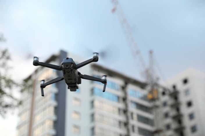
Drone surveying uses unmanned aerial vehicles equipped with high-resolution cameras and sensors to capture detailed images and spatial data from above. The collected data is processed to generate three-dimensional models, digital terrain maps, and detailed orthomosaic images that provide a complete picture of site conditions.
Unlike standard ground surveys that require extensive field time, drone surveys capture a vast amount of data in a short period, covering large and complex sites with ease.
Enhanced Accuracy and Coverage
One of the most compelling benefits of drone surveying is the level of accuracy it delivers. Drones can capture thousands of overlapping high-resolution images that, when stitched together, produce centimetre-accurate topography and surface models.
This level of detail is particularly valuable on sites with uneven terrain, difficult access, or extensive vegetation. Traditional methods may struggle to map these features thoroughly, whereas drone data can fill in gaps and reveal subtle variations that would otherwise go unnoticed.
Integrating drone outputs with trusted topographic surveys provides an enhanced understanding of site conditions that supports better design, planning, and decision making.
Faster Data Collection and Processing
Traditional survey crews walk entire sites and set up instruments at multiple locations. This takes time and can be slowed by steep slopes, waterways, or dense vegetation. Drone surveys reduce field time significantly by capturing real-time aerial data across the entire property in a single flight.
After data capture, processing software converts raw imagery into detailed maps and 3D models. This rapid turnaround means project teams get reliable information sooner, which helps reduce delays in early project stages. When clients pair drone outputs with expert subdivision surveying, they benefit from both speed and precision, particularly during feasibility assessments.
Improved Safety on Challenging Sites
Surveying steep, hazardous, or environmentally sensitive sites can be risky for personnel. Drones remove the need for surveyors to physically access every part of the site, enhancing safety while still gathering crucial spatial information.
For properties with unstable ground, cliffs, or dense bush, a drone gives a bird’s-eye view without exposing field staff to unnecessary risk. This makes drone surveying an effective option for both urban and rural scenarios, such as large blocks or terrain affected by erosion.
Cost Efficiency Without Compromising Quality
While advanced technology might suggest higher cost, drone surveys often reduce overall project expenditure. Faster field work and quicker data delivery decrease labour hours on site. At the same time, the enriched data set reduces the likelihood of rework caused by incomplete information.
When combined with accurate boundary surveys, drone data helps eliminate surprises during design or construction, ensuring the project stays closer to budget and schedule. Clients frequently find that the investment in aerial data pays dividends through improved planning and fewer unexpected challenges.
Better Insights for Planning, Design, and Construction
Drone surveying captures information that can be shared visually with teams across disciplines, such as planners, engineers, and architects. The high-resolution orthomosaic images provide a clear visual context that makes it easier to identify constraints and opportunities early on.
For example, when planning civil works, drone data can reveal subtle drainage patterns. During architectural design, it can help optimise building placement and orientation. In construction, aerial updates allow stakeholders to monitor progress against design intent.
These benefits are amplified when integrated with detailed land development planning, because aerial insights provide a reliable baseline for each stage of the project.
Trends Shaping Drone Surveying Toward 2026
Technology evolves quickly, and drone surveying is no exception. Below are several trends expected to influence land surveying by 2026:
Greater Regulation and Standardisation
As drone use becomes more widespread, aviation and privacy regulations in New Zealand are adapting. Operators will continue to require appropriate certification and flight planning to comply with evolving standards. Survey practices may incorporate more formal quality assurance protocols that align drone outputs with statutory surveying requirements.
Enhanced Sensor Capabilities
Future drones will increasingly incorporate advanced sensors such as LiDAR and multispectral cameras. These additions will enable more rich datasets, including vegetation analysis, sub-canopy terrain modelling, and more detailed surface characterisation.
Improved Integration with BIM and GIS
As project delivery systems adopt digital platforms for information management, drone data will integrate more seamlessly into Building Information Modelling (BIM) and Geographic Information Systems (GIS), improving cross-discipline collaboration.
Automated Flight and Processing
Software will continue to reduce manual steps in data capture and processing, making drone surveying even more efficient. AI-assisted workflows may automate feature extraction so that outputs are more immediately usable for design and compliance tasks.
Fluker Surveying stays ahead of these trends to ensure clients benefit from cutting-edge methods while maintaining the rigour expected in cadastral and engineering workflows.
Talk to Fluker Surveying About Your Next Project
Drone surveying can increase confidence in your planning and reduce uncertainty. At Fluker Surveying, we combine advanced imaging technology with detailed surveying expertise to deliver results you can trust.
If you are planning a project that could benefit from fast, accurate, and rich spatial data, get in touch. We can help you understand how drone surveying fits into your wider project needs and support you from initial assessment through to final documentation.

