
What Is Land Surveying?
If you’re involved in property, construction, or land development, you’ve likely heard the term “land surveying.” In simple terms, land surveying is the art and science of measuring and mapping land so we know exactly where everything is. Surveyors collect precise data about distances, angles, heights, and features, then turn that information into plans and maps used for titles, design, and construction.
This work underpins almost every successful project in New Zealand, from a fence realignment through to a multi-lot subdivision or a new highway. Below, we explain what surveyors do, why their work matters, and when you should call one.
Definition: Measuring and mapping the land
Land surveying determines the positions of points on the Earth’s surface and the distances and angles between them. In practical terms, surveyors:
- Measure lengths, angles, and elevations on site.
- Map boundaries, terrain and features.
- Produce plans and digital models used for design, construction, and legal records.
The goal is certainty. Accurate measurements give councils, designers, builders, and owners the confidence to plan and build in the right place, to the right dimensions.
What do land surveyors do?
A surveyor’s role goes far beyond a tripod and telescope. Typical services include:
1) Establishing property boundaries
Surveyors research historical records, locate or reinstate boundary marks (pegs), and prepare legal survey datasets for title purposes. In New Zealand, only Licensed Cadastral Surveyors can define legal boundaries and lodge cadastral surveys with Toitū Te Whenua Land Information New Zealand (LINZ). Correct boundaries prevent disputes and protect your investment.
2) Topographic (site) surveys
A topographical survey maps ground levels, contours, buildings, trees, services, and other site features. Architects and engineers rely on this as the base layer for design work, from earthworks to drainage and access.
3) Construction set-out
Surveyors transfer the approved design onto the ground. They mark where foundations, walls, roads, and services must be built so everything sits in the correct location and to the correct level.
4) As-built surveys
After or during construction, surveyors record what has been built and where. Councils often require as-built plans for new infrastructure and subdivisions.
5) Subdivision and land development planning
Many surveyors advise on development feasibility, subdivision layout, roading, lot sizes, and compliance. They bridge the legal and physical sides of development by designing practical layouts and completing the legal survey work for new titles.
6) Geodetic and control surveys
These high-precision surveys tie local work to national coordinate systems and datums so mapping and GPS data align correctly.
Why is land surveying important?
- Accurate data prevents costly mistakes. Design and construction decisions are only as good as the measurements they rely on. Early errors can snowball into design changes, delays, or legal issues.
- Clear boundaries avoid disputes. Properly surveyed boundaries provide certainty for owners and neighbours and form the basis for new titles.
- Compliance and approvals. Surveys demonstrate setback compliance, building positions, access widths, easements, and more, supporting resource and building consents.
- Enables infrastructure. Roads, utilities, bridges, and buildings depend on precise set-out and ongoing monitoring.
- Trusted records. Survey plans become part of NZ’s official record, keeping our land information consistent and reliable.
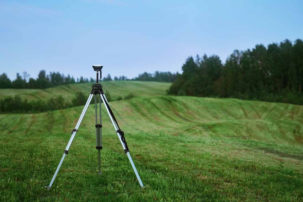
Tools and technology surveyors use
Modern surveyors combine field craft with advanced tech:
- Total stations to measure angles and distances with millimetre-level precision.
- GNSS (survey-grade GPS) for fast, accurate positioning over large sites.
- 3D laser scanning and LiDAR to capture dense point clouds for complex structures and as-builts.
- Drones (UAVs) to efficiently map large or hard-to-reach areas and produce orthophotos and elevation models.
- CAD and GIS software to process measurements into clear plans, models, and datasets.
Equipment is only part of the picture. Professional judgement, robust procedures, and quality control ensure reliable outcomes.
Land Surveying in New Zealand
- Licensed Cadastral Surveyors. Only licensed professionals can legally define or redefine property boundaries for titles in NZ. They must meet strict competency standards and follow the Cadastral Survey Rules.
- LINZ and Landonline. Cadastral surveys are lodged with LINZ, checked, and recorded in the national system. This keeps titles and survey data consistent nationwide.
- Varied terrain and heritage. From urban lots to rural and coastal sites, NZ’s terrain and history mean surveyors often reconcile historic records with current conditions, while allowing for hazards, overlays, and local rules.
When should you call a Land Surveyor?
- Buying or selling property. Confirm boundaries and locate pegs.
- Designing a new home or extension. Get a topo survey and boundary confirmation before design starts.
- Building near a boundary. Mark boundaries and setbacks to avoid encroachment.
- Subdivision or development. Plan layouts, meet district plan standards, and create new titles.
- Boundary uncertainty or disputes. Re-establish the legal line with licensed expertise.
- Major construction or infrastructure. Set-out and as-built checks for accuracy and compliance.
Get in Touch with Flukey Surveying
Land surveying is the backbone of accurate land information in all of New Zealand. It gives owners clarity about boundaries, gives designers and builders trustworthy data, and gives councils confidence that projects comply. Whether you need a simple boundary check or full project support from feasibility to titles, a licensed surveyor provides the certainty your project depends on.
Ready to talk to a surveyor? Fluker Surveying Ltd supports homeowners, developers, and contractors across Auckland and beyond with boundary surveys, topographic surveys, construction set-out, subdivision planning, and more.
FAQs: Land Surveying in New Zealand
Is land surveying only about property boundaries?
No. Boundary surveying is a core part of it, but land surveying covers much more. Surveyors also map land topography, set out construction works, measure heights and angles for engineering projects, and create detailed plans for land development. Essentially, any task that requires precise measurement and mapping of land features falls under land surveying.
How accurate are land surveys?
Very accurate. Licensed surveyors use high-precision instruments; their measurements are typically accurate to within a few millimeters for boundary work. The Cadastral Survey Rules in NZ mandate strict accuracy standards for boundary surveys. For example, in urban areas, boundaries are usually fixed with an uncertainty of only a few centimetres or less. Construction set-out is also done with millimeter-level precision to ensure buildings go up exactly per plan. Of course, the level of accuracy needed can depend on the project. A fence line survey might not need the ultra-high precision that a suspension bridge alignment would – but surveyors will always aim for the necessary precision with a margin of safety.
What’s the difference between a land surveyor and a civil engineer or architect?
A land surveyor’s expertise is in measurement, mapping, and land law (boundaries), whereas architects focus on building design/aesthetics and civil engineers focus on designing infrastructure/structural elements. Generally, surveyors set the spatial framework within which architects and engineers work. Surveyors find and mark the key reference points; engineers and architects design between those points. All three professions work closely together on projects.
When do I need a licensed cadastral surveyor?
You need a licensed cadastral surveyor whenever you are defining or altering legal property boundaries. So, if you’re subdividing land, adjusting a boundary with a neighbor, or needing a title plan for its legal description, only a licensed cadastral surveyor can do that work. They will carry out the survey, place new boundary marks (pegs), and prepare a cadastral survey dataset to lodge with LINZ for new titles. If you just want to locate existing boundaries (or find the pegs on your section) you should also hire a licensed surveyor. For other surveying tasks like topographic surveys or construction set-out, a registered professional surveyor isn’t strictly required, but many NZ surveyors are licensed and will handle all types of surveying.
How much does a land survey cost in NZ?
Costs can vary widely depending on the job’s complexity, size, and location. A simple residential boundary marking might cost a few hundred to a couple of thousand dollars, whereas a subdivision survey (with new titles) will be a few thousand or more per lot, considering all the work and council fees involved. Large projects can run into tens of thousands. When evaluating cost, remember that an accurate survey can save you from very expensive problems like legal disputes or construction errors, making it a worthwhile investment. We at Fluker Surveying provide quotes tailored to each job, and we’re happy to discuss scope and costs upfront so you know what to expect.
What is a Registered Professional Surveyor?
Such a surveyor has undertaken extensive on the job preparation and learning through many years post university graduation to become a Registered Professional Surveyor. They are not limited to just surveying and are often trained in resource consent planning and civil engineering as their preference allows. They are required to meet stringent initial standards and then are also required to undertake continuing professional development each year to stay up to date, skillful and reliable.

