
Flood Zones and Natural Hazards: How They Impact Development in Auckland
When you are planning a development or construction project in Auckland, understanding natural hazards is essential. Flood zones, land instability, coastal inundation and other hazard overlays affect safety, consent requirements, design, infrastructure costs, and long term value.
At Fluker Surveying, we help property owners and developers navigate these complexities with certainty. Accurate surveying and early risk identification can save time and cost while improving compliance with council expectations.
In this guide, we explain how natural hazards and flood zones influence development in Auckland, what property owners need to know, and how Auckland surveyors can help you take control of any challenges that arise.
What Are Natural Hazards and Why They Matter
Natural hazards are environmental conditions that pose risk to people, property, or infrastructure. The most common hazards relevant to urban and rural development in Auckland include:
- Flood risk and inundation zones
- Erosion or unstable ground
- Coastal inundation
- Landslip or slope instability
- Stormwater overflow areas
Councils map these hazard areas and often include them in planning rules to protect lives and reduce property risk. These zones are considered when assessing building consents, resource consents, subdivision applications and infrastructure design. Ignoring them can cause delays during the consenting process and incur higher construction or mitigation costs.
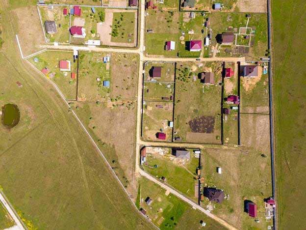
Flood Zones and Development Constraints
Flood zones are areas identified as being susceptible to flooding due to heavy rain, storm events, or overflow from rivers and streams. Auckland’s planning framework identifies flood plains and low lying areas that require careful treatment.
If your property is in a flood zone, council may require additional assessments, such as hydrological analysis or engineered stormwater management plans. Structures may need to be elevated, or land may need earthworks to manage runoff.
A topographic survey is an essential first step here. It provides detailed information about ground levels, contours, and existing drainage patterns that help engineers design solutions that reduce flood risk. Without this data, designs may not satisfy council or insurance requirements.
Slope Instability and Landslip Risk
Many parts of Auckland have rolling terrain and steep slopes. These areas can be prone to instability during heavy rain or seismic activity. Planning rules often require evidence that proposed building pads, roads, retaining walls and driveways are on stable ground.
Survey data is a key input for geotechnical assessments and foundation design. Fluker Surveying can provide accurate land data that engineers use to identify risk and propose mitigation, helping move projects through council review more smoothly.
Coastal Hazards and Sea Level Rise
Coastal inundation zones are another natural hazard that affects property development, particularly in areas near beaches, estuaries and harbours. The reality of rising sea levels and more frequent storm surges means councils are taking a more precautionary approach when assessing applications near the coast.
Development in coastal hazard zones may require setback distances, elevated foundations, or other structural measures to protect buildings and infrastructure. A detailed flood risk assessment supported by accurate site data helps planners and engineers determine what is appropriate for each site.
Regulatory Implications for Development
Natural hazards influence council requirements in several ways:
Resource Consents
If your site lies within a flood plain or other mapped hazard, a standard building consent may not be sufficient. Resource consent often requires extra technical reports and demonstration that your design mitigates risk.
Council planners and engineers will look for evidence from qualified professionals that the proposed works will not significantly increase risk to people or property. This is where surveys that integrate hazard identification data are invaluable.
Subdivision and Infrastructure
Before new titles are created, councils must be satisfied that land will remain safe and drain effectively. Hazard overlays may influence how many lots can be approved, where roads and services are placed, or whether external works are required to manage stormwater.
A subdivision survey combined with early hazard analysis gives you clarity on what is possible before significant design work begins.
How Early Surveying Protects Your Project
Many risks associated with hazard zones can be mitigated with early, accurate information. Engaging a professional surveyor helps you:
- Identify hazard constraints before design begins
- Provide data for engineered mitigation solutions
- Support technical reports for council applications
- Reduce risk of redesign and consent delays
For example, combining a boundary survey with natural hazard data ensures that works are set out in the correct locations and do not conflict with hazard constraints. Similarly, topo data helps engineers design drainage that minimises flood risk.
Talk to Fluker Surveying About Natural Hazards and Your Site
Natural hazards and flood risk are not reasons to abandon a development. With early assessment, professional advice and accurate data, you can design with confidence and demonstrate to council that risks are managed.
Fluker Surveying provides practical support that helps property owners and developers navigate hazard constraints. We can assist with topographic surveys, subdivision surveying, boundary surveys, resource consent applications and land development planning, giving you clarity at every stage of the project.
Get in touch with Fluker Surveying today to discuss your property and find out how we can help you take control of natural hazards in your planning and design process.

